
FEMA Interactive Maps Show Flood-Prone Areas in Valley
0 seconds of 0 secondsVolume 90%
Press shift question mark to access a list of keyboard shortcuts
Keyboard Shortcuts
Shortcuts Open/Close/ or ?
Play/PauseSPACE
Increase Volume↑
Decrease Volume↓
Seek Forward→
Seek Backward←
Captions On/Offc
Fullscreen/Exit Fullscreenf
Mute/Unmutem
Decrease Caption Size-
Increase Caption Size+ or =
Seek %0-9
Some Weslaco homeowners say their area isn’t on the map, but should be.
Norma Rodriguez says she has lived through two floods in the Las Brisas subdivision, moved once, and is now renting a home.
“The next step is research where I’m going to moving to and take it from there more than anything; research no flooding zones hopefully," says Rodriguez.
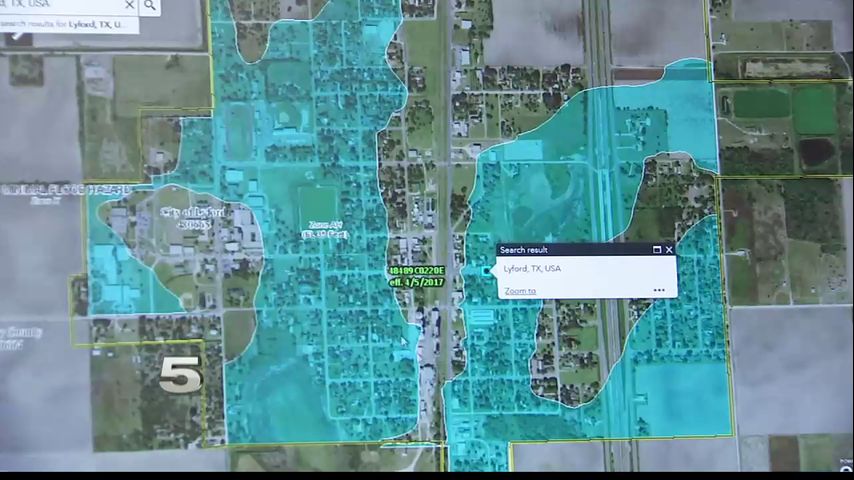
Homeowners or renters like Rodriguez can use FEMA’s interactive map to indentify high risk flooding areas.
In each of the areas, the map highlights a zone letter explaining the level of risk associated.
FEMA explains flood maps may change or be revised over time.
For more information watch the video above.
More News


Radar
7 Days

